Help
Help
 Duke4.net
 DNF #1
 Duke 3D #1

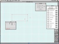
I had a question in regards to selection of different "heights" in Mapster32. Way back in the Mac OS 9.8 era, I used a Mac Build editor called DukeEdit. This editor had a feature called "stratum", which allowed you to only see sectors and sprite within the selected Zmin and Zmax (see picture). It made sector-over-sector editing really easy compared to the spaghetti of lines it can now result in, as you could simply make floors you're not editing invisible.
I've been trying to find this feature in Mapster32, but I can't find it. I'm assuming it was never implemented in the Windows Build/Mapster32 editor ( maybe the guy who ported the Mac variant came up with it on his own) but I was wondering if such a thing exists in Mapster32, and if not, if it is technically possible to implement it?
If not, I'll have to suck it up I guess

Thanks for your time
EDIT:
 MetHy, on 09 November 2016 - 10:16 AM, said:
Check the EDuke32 wiki for list of keys.
Select a sector with altgr; then press CTRL+R. It will grey out any sector not on the same height level.
Additionnaly you can use 2D/3D view mode (F3 ; change the view with Q and W)
Select a sector with altgr; then press CTRL+R. It will grey out any sector not on the same height level.
Additionnaly you can use 2D/3D view mode (F3 ; change the view with Q and W)